Conservation Scientist
Trainee
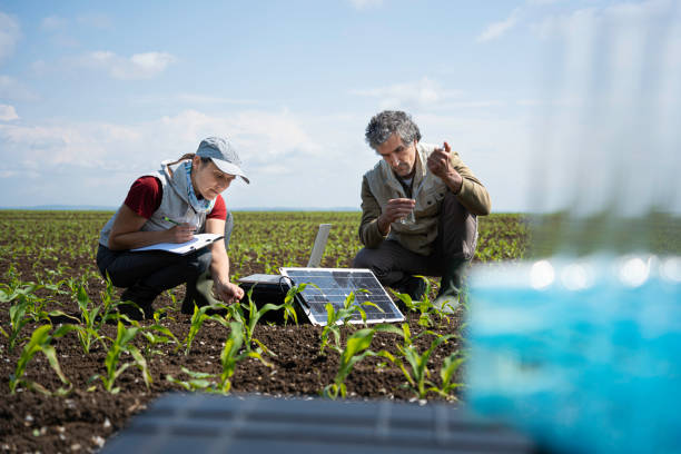
Explore CareerAn Agricultural GIS & Remote-Sensing Analyst is a professional who specializes in using Geographic Information Systems (GIS) and remote-sensing technologies to analyze spatial data for agricultural applications, such as crop monitoring, land use planning, and yield prediction. They work in agricultural research institutions, government agencies, agribusiness companies, and environmental organizations, collaborating with farmers, scientists, and policymakers. Agricultural GIS & Remote-Sensing Analysts play a crucial role in enhancing agricultural productivity and sustainability by providing data-driven insights in a sector focused on precision farming, resource management, and climate adaptation.
An Agricultural GIS & Remote-Sensing Analyst is a professional who specializes in using Geographic Information Systems (GIS) and remote-sensing technologies to analyze spatial data for agricultural applications, such as crop monitoring, land use planning, and yield prediction. They work in agricultural research institutions, government agencies, agribusiness companies, and environmental organizations, collaborating with farmers, scientists, and policymakers. Agricultural GIS & Remote-Sensing Analysts play a crucial role in enhancing agricultural productivity and sustainability by providing data-driven insights in a sector focused on precision farming, resource management, and climate adaptation.
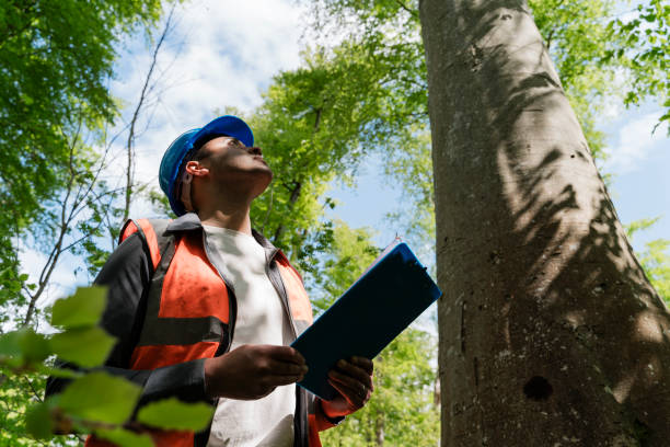
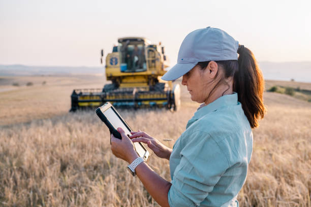
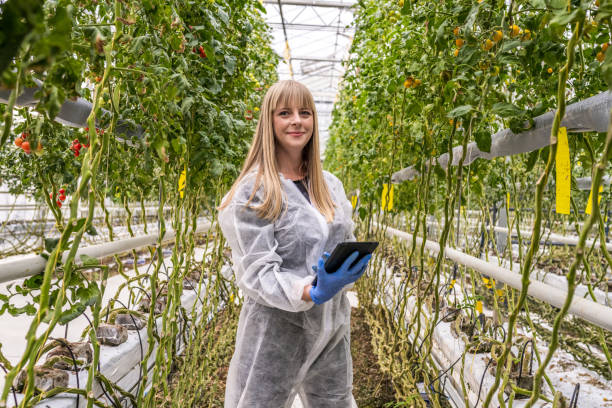
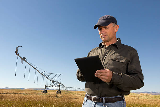
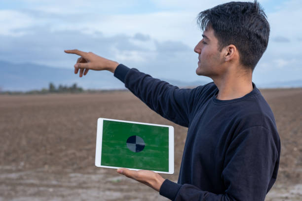
Agricultural GIS & Remote-Sensing Analysts are technical and analytical experts responsible for collecting, processing, and interpreting spatial data to support agricultural decision-making, ensuring efficient land use, crop health monitoring, and resource allocation. Their role involves using satellite imagery, drones, and GIS software to map agricultural landscapes, often working in office settings or field environments. They combine knowledge of geospatial technology, agronomy, and data analysis to address challenges like soil degradation, water scarcity, and climate variability. As key contributors to precision agriculture, they help shape sustainable practices in an industry increasingly focused on data-driven farming, environmental conservation, and food security.
Roles and Responsibilities
Study Route & Eligibility Criteria
| Route | Steps |
| Route 1 | 1. 10+2 with Physics, Chemistry, Biology (PCB) or Mathematics (PCM) 2. Bachelor’s degree in Agriculture, Geography, or Geoinformatics (3-4 years) 3. Internship or field training (3-6 months) 4. Practice as Junior Agricultural GIS & Remote-Sensing Analyst |
| Route 2 | 1. 10+2 with PCB or PCM 2. Bachelor’s degree in Agriculture, Geography, or Environmental Science (3-4 years) 3. Master’s degree in Geoinformatics, Remote Sensing, or GIS (2 years) 4. Work as Agricultural GIS & Remote-Sensing Analyst |
| Route 3 | 1. 10+2 with PCB or PCM 2. Bachelor’s degree in Agriculture or Geography (3-4 years) 3. Master’s degree in Geoinformatics or Remote Sensing (2 years) 4. Ph.D. in Geospatial Science or Agricultural Informatics (3-5 years) 5. Practice as Senior Researcher or Academic |
| Route 4 | 1. 10+2 with PCB or PCM 2. Advanced international training or certification in GIS and Remote Sensing (1-2 years) 3. Master’s or Ph.D. as per country requirements 4. Practice abroad or in India |
Significant Observations (Academic Related Points)
Internships & Practical Exposure
Courses & Specializations to Enter the Field
Top Institutes for Agricultural GIS & Remote-Sensing Analyst Education (India)
| Institute | Course/Program | Official Link |
| Indian Agricultural Research Institute (IARI), New Delhi | M.Sc./Ph.D. in Agricultural Informatics | https://www.iari.res.in/ |
| Tamil Nadu Agricultural University (TNAU), Coimbatore | B.Sc./M.Sc. in Agriculture (GIS Focus) | https://www.tnau.ac.in/ |
| University of Agricultural Sciences (UAS), Bangalore | B.Sc./M.Sc. in Agriculture (Geoinformatics) | https://www.uasbangalore.edu.in/ |
| Punjab Agricultural University (PAU), Ludhiana | B.Sc./M.Sc. in Agriculture (Remote Sensing Focus) | https://www.pau.edu/ |
| Anand Agricultural University (AAU), Gujarat | B.Sc./M.Sc. in Agriculture (GIS Focus) | https://www.aau.in/ |
| Kerala Agricultural University (KAU), Thrissur | B.Sc./M.Sc. in Agriculture (Geoinformatics) | https://www.kau.in/ |
| Indian Institute of Remote Sensing (IIRS), Dehradun | M.Tech./Certificate in Remote Sensing & GIS | https://www.iirs.gov.in/ |
| Banaras Hindu University (BHU), Varanasi | B.Sc./M.Sc. in Geography/GIS | https://www.bhu.ac.in/ |
| Bidhan Chandra Krishi Viswavidyalaya (BCKV), West Bengal | B.Sc./M.Sc. in Agriculture (GIS Focus) | https://www.bckv.edu.in/ |
| Amity University, Noida | B.Sc./M.Sc. in Geoinformatics | https://www.amity.edu/ |
Top International Institutes
| Institution | Course | Country | Official Link |
| Wageningen University & Research | Geoinformatics and Remote Sensing Programs | Netherlands | https://www.wur.nl/ |
| University of California, Davis | Agricultural GIS and Remote Sensing Programs | USA | https://www.ucdavis.edu/ |
| Cornell University | Precision Agriculture and GIS Programs | USA | https://www.cornell.edu/ |
| University of Arizona | Remote Sensing and GIS Programs | USA | https://www.arizona.edu/ |
| University of Guelph | Agricultural GIS and Technology Programs | Canada | https://www.uoguelph.ca/ |
| University of Queensland | Geospatial Science Programs | Australia | https://www.uq.edu.au/ |
| Swedish University of Agricultural Sciences (SLU) | Geoinformatics and Sustainability Programs | Sweden | https://www.slu.se/ |
| University of Copenhagen | Geospatial and Agricultural Programs | Denmark | https://www.ku.dk/ |
| National University of Singapore (NUS) | Geoinformatics and Technology Programs | Singapore | https://www.nus.edu.sg/ |
| ETH Zurich | Geospatial Science and Technology Programs | Switzerland | https://www.ethz.ch/ |
Entrance Tests Required
India:
International:
Ideal Progressing Career Path
Trainee → Junior Agricultural GIS & Remote-Sensing Analyst → Senior Agricultural GIS & Remote-Sensing Analyst → Geospatial Project Manager → Precision Agriculture Specialist → Research Scientist → Academician/Professor → Geospatial Consultant
Major Areas of Employment
Prominent Employers
| India | International |
| Indian Council of Agricultural Research (ICAR) | Esri, USA |
| Indian Space Research Organisation (ISRO) | NASA Earth Science Division, USA |
| National Remote Sensing Centre (NRSC), Hyderabad | European Space Agency (ESA), Netherlands |
| CropIn, Bangalore | Planet Labs, USA |
| Mahalanobis National Crop Forecast Centre (MNCFC) | DigitalGlobe (Maxar Technologies), USA |
| Skymet Weather Services, Noida | Trimble Agriculture, USA |
| RMSI, Noida | Airbus Defence and Space, France |
| Geosys India, Pune | Sentinel Hub (Sinergise), Slovenia |
| State Agricultural Universities | AgriWatch, Canada |
| Tata Consultancy Services (TCS) - AgTech Division | John Deere Precision Ag, USA |
Pros and Cons of the Profession
| Pros | Cons |
| Opportunity to contribute to precision agriculture and sustainability through data-driven insights | High dependency on technology and data accuracy, which can be affected by technical glitches |
| High demand for experts in geospatial analysis due to the rise of precision farming | Requires continuous learning to keep up with rapidly evolving GIS and remote-sensing technologies |
| Rewarding impact on food security through optimized land and resource use | Fieldwork can be physically demanding and time-intensive for data validation |
| Diverse career paths across research, government, and private sectors | Limited public recognition compared to mainstream agricultural roles |
| Strong potential for growth with increasing focus on data-driven agriculture and climate adaptation | Risk of data misinterpretation affecting agricultural decisions despite best efforts |
Industry Trends and Future Outlook
Salary Expectations
| Career Level | India (₹ per annum) | International (USD per annum) |
| Trainee/Junior Agricultural GIS & Remote-Sensing Analyst (Early Career) | 3,00,000 - 5,00,000 | 30,000 - 45,000 |
| Senior Agricultural GIS & Remote-Sensing Analyst (Mid-Career) | 5,00,000 - 8,00,000 | 45,000 - 70,000 |
| Geospatial Project Manager | 8,00,000 - 12,00,000 | 70,000 - 90,000 |
| Precision Agriculture Specialist/Research Scientist | 12,00,000 - 16,00,000 | 90,000 - 120,000 |
| Academician/Professor/Geospatial Consultant | 16,00,000+ | 120,000+ |
| Note: Salaries may vary based on location, employer, experience, and specialization. |
Key Software Tools
Professional Organizations and Networks
Notable Agricultural GIS & Remote-Sensing Analysts and Industry Leaders (Top 10)
Advice for Aspiring Agricultural GIS & Remote-Sensing Analysts
A career as an Agricultural GIS & Remote-Sensing Analyst offers a unique opportunity to contribute to precision agriculture and sustainability by leveraging spatial data to address critical challenges in farming and resource management. From mapping crop health to predicting yields with remote-sensing tools, Agricultural GIS & Remote-Sensing Analysts play a pivotal role in modern agriculture and environmental stewardship. This field combines technical expertise, analytical innovation, and a commitment to food security, offering diverse paths in research, government, and private sectors. For those passionate about shaping precision farming trends, adapting to global agricultural challenges, and addressing critical sustainability needs in an era of data-driven decision-making, a career as an Agricultural GIS & Remote-Sensing Analyst provides an intellectually stimulating and professionally rewarding journey with the potential to make significant contributions to society by enhancing the efficiency of agricultural practices and industry standards worldwide.

Early-career professionals handle basic spatial data analysis and mapping with increasing autonomy. They hone skills in image processing and crop...
0.0LPA
Experienced professionals manage complex geospatial projects with high accuracy, using advanced methodologies. They offer technical expertise in...
0.0LPA
Specialists oversee large-scale GIS and remote-sensing projects with exceptional competence. They integrate deep geospatial knowledge with...
0.0LPA
Take the next step and explore more about Agricultural GIS & Remote-Sensing Analyst.
Explore similar career paths that might interest you