Geohydrologist

A Geohydrologist studies the distribution, movement, and quality of groundwater in the Earth's crust. They analyze how water interacts with geological formations and assess the availability and sustainability of groundwater resources. Geohydrologists apply principles of geology, hydrology, and environmental science to solve problems related to water supply, contamination, and resource management.
Share :
Career tree mind map (horizontal) — Geohydrologist
Colored branches, hub circles, and underlined topics — same style as counselor course classic (types 18–19 in admin).
Loading mind map…

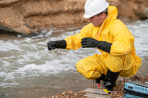
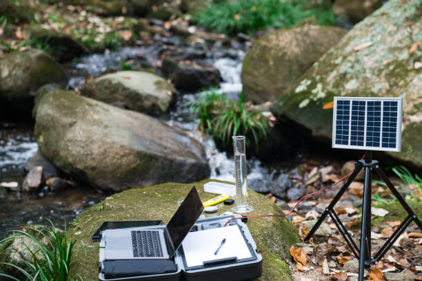
Geohydrologists investigate groundwater systems by studying aquifers, soil permeability, and rock formations to understand how water flows underground. They collect and analyze data through field surveys, drilling, sampling, and geophysical techniques. Their work involves assessing groundwater quality, predicting the impact of human activities, and designing sustainable water management plans. Geohydrologists play a key role in environmental protection, urban planning, agriculture, and disaster management by ensuring safe and reliable water resources. They collaborate with environmental scientists, engineers, policymakers, and communities to address water-related challenges.

  1. Groundwater Exploration and Mapping
    • Conduct field surveys and use geophysical methods to locate and map aquifers.
  2. Data Collection and Analysis
    • Collect water samples and analyze chemical, physical, and biological properties.
  3. Hydrological Modeling
    • Develop models to simulate groundwater flow and predict future availability.
  4. Environmental Impact Assessment
    • Assess effects of industrial, agricultural, and urban activities on groundwater quality.
  5. Groundwater Resource Management
    • Design sustainable extraction and recharge strategies to prevent depletion.
  6. Contamination Investigation and Remediation
    • Identify sources of pollution and recommend cleanup or prevention measures.
  7. Report Preparation and Documentation
    • Prepare technical reports, maps, and presentations for stakeholders.
  8. Collaboration and Consultation
    • Work with government agencies, environmental organizations, and private firms.

RouteSteps
Route 1: Bachelor’s in Geology / Earth Sciences1. Complete a Bachelor’s degree in Geology, Earth Sciences, or Environmental Science.
2. Pursue Master’s specializing in Hydrogeology or Geohydrology.
3. Gain fieldwork and laboratory research experience.
4. Seek employment in environmental consultancies, government agencies, or research institutes.
Route 2: Civil Engineering + Water Resources1. Obtain a degree in Civil Engineering with focus on water resources.
2. Specialize in groundwater hydrology through postgraduate studies.
3. Participate in projects related to water management and environmental engineering.
4. Advance into hydrogeological roles in engineering firms or public sector.
Route 3: Environmental Science + Hydrology1. Earn a degree in Environmental Science or Hydrology.
2. Focus on groundwater studies and environmental impact assessments.
3. Engage in internships with environmental agencies.
4. Pursue advanced research and consultancy roles.
Route 4: Geophysics + Hydrology1. Complete a degree in Geophysics or Applied Geophysics.
2. Develop skills in geophysical survey methods and groundwater modeling.
3. Conduct interdisciplinary research projects.
4. Pursue graduate degrees and field specialization.

  • Fieldwork-intensive profession requiring physical and analytical skills.
  • Interdisciplinary knowledge combining geology, hydrology, chemistry, and environmental science.
  • Increasing importance due to global water scarcity and pollution issues.
  • Requires proficiency in GIS, hydrological modeling software, and geophysical tools.
  • Collaboration with policymakers and community stakeholders is essential.
  • Growing demand in environmental consulting, government water management, and research sectors.
  • Involves addressing critical challenges like groundwater contamination and sustainable use.
  • Opportunities for international work in water resource management and environmental protection.

  • Field internships involving groundwater sampling, drilling supervision, and site surveys.
  • Laboratory experience in water quality testing and chemical analysis.
  • Training in hydrological and groundwater modeling software (MODFLOW, ArcGIS).
  • Participation in environmental impact assessment projects.
  • Exposure to geophysical survey techniques like resistivity, seismic, and ground-penetrating radar.
  • Collaboration with environmental agencies and water resource departments.
  • Engagement in research projects on groundwater recharge and contamination.
  • Involvement in policy formulation and community water management programs.
  • Use of remote sensing and GIS for groundwater mapping.
  • Attendance at workshops and conferences on hydrogeology and environmental science.

  • Bachelor’s degrees in Geology, Earth Sciences, Environmental Science, Civil Engineering.
  • Master’s programs specializing in Hydrogeology, Groundwater Hydrology, Environmental Geology.
  • Courses in Hydrogeology, Geochemistry, Environmental Chemistry, and Soil Science.
  • Training in Groundwater Modeling (MODFLOW), Geographic Information Systems (GIS).
  • Courses on Water Resource Management, Environmental Impact Assessment, and Pollution Control.
  • Geophysical survey methods and data interpretation.
  • Research methodology and scientific writing.
  • Hydrological data analysis and statistical methods.
  • Regulatory frameworks and environmental law related to water resources.
  • Field methods in groundwater exploration and sampling.

InstituteCourse / ProgramOfficial Link
Indian Institute of Technology (IIT) RoorkeeHydrogeology and Water Resourceshttps://www.iitr.ac.in/
National Institute of Hydrology (NIH), RoorkeeHydrogeology and Groundwater Studieshttps://nihroorkee.gov.in/
Indian Institute of Science (IISc), BangaloreEarth Sciences and Environmental Sciencehttps://iisc.ac.in/
Banaras Hindu University (BHU)Geology and Hydrogeologyhttps://www.bhu.ac.in/
Jawaharlal Nehru University (JNU), DelhiEnvironmental Scienceshttps://www.jnu.ac.in/
University of HyderabadEarth and Environmental Scienceshttps://www.uohyd.ac.in/
Aligarh Muslim University (AMU)Geology and Hydrogeologyhttps://www.amu.ac.in/
Central University of RajasthanEnvironmental Science and Hydrogeologyhttps://www.curaj.ac.in/
Anna UniversityCivil Engineering – Water Resourceshttps://www.annauniv.edu/
Tata Institute of Fundamental Research (TIFR)Earth Scienceshttps://www.tifr.res.in/

International

InstitutionCourseCountryOfficial Link
Stanford UniversityEarth System Science and HydrogeologyUSAhttps://stanford.edu/
Massachusetts Institute of Technology (MIT)Earth, Atmospheric, and Planetary SciencesUSAhttps://mit.edu/
University of California, BerkeleyHydrology and Water ResourcesUSAhttps://berkeley.edu/
University of CambridgeEarth Sciences and HydrogeologyUKhttps://cam.ac.uk/
ETH ZurichEnvironmental GeosciencesSwitzerlandhttps://ethz.ch/
University of OxfordEarth SciencesUKhttps://www.ox.ac.uk/
University of TorontoEarth Sciences and HydrologyCanadahttps://www.utoronto.ca/
Delft University of TechnologyWater Management and HydrogeologyNetherlandshttps://www.tudelft.nl/
University of MelbourneEnvironmental Science and HydrogeologyAustraliahttps://www.unimelb.edu.au/
Technical University of Munich (TUM)Environmental Engineering and HydrogeologyGermanyhttps://www.tum.de/

India

  • JEE Advanced: For admission to IITs for undergraduate engineering and earth science programs.
  • GATE (Graduate Aptitude Test in Engineering): For postgraduate admissions and recruitment in engineering, earth sciences, and environmental science fields.
  • CSIR-UGC NET (Council of Scientific & Industrial Research - University Grants Commission National Eligibility Test): For research fellowships and junior research positions in earth and environmental sciences.
  • IIT JAM (Joint Admission Test for M.Sc.): For admission to MSc programs in earth sciences and related fields.
  • State-level Engineering and Science Entrance Exams: Various state-specific exams for admission to universities offering geology, hydrogeology, and environmental science courses.
  • University-specific Entrance Exams and Interviews: For postgraduate and doctoral programs in hydrogeology and geosciences.


International

  • GRE (Graduate Record Examination): For admission to graduate programs in earth sciences, environmental science, and engineering worldwide.
  • TOEFL (Test of English as a Foreign Language): For English language proficiency required by many international universities.
  • IELTS (International English Language Testing System): Another widely accepted English proficiency test for international admissions.
  • University-specific Entrance Exams and Interviews: Some universities require additional assessments or interviews for graduate admissions.
  • Professional Certification Exams: In hydrogeology or environmental management, offered by international bodies or institutions, depending on career focus.

Undergraduate Student → Graduate Student (MSc/PhD) → Junior Geohydrologist / Research Assistant → Geohydrologist / Hydrogeologist → Senior Consultant / Project Manager → Principal Hydrogeologist / Lead Scientist → Director / Head of Water Resource Management

  • Environmental consulting firms
  • Government water resource and environmental agencies
  • Research institutions and universities
  • Mining and petroleum industries
  • Agricultural and irrigation departments
  • Urban and regional planning organizations
  • Water treatment and remediation companies
  • Non-governmental organizations (NGOs) focused on water and environment
  • International development and aid organizations
  • Geotechnical and civil engineering firms
  • Hydropower and infrastructure development companies

IndiaInternational
Central Ground Water Board (CGWB)United States Geological Survey (USGS)
National Institute of Hydrology (NIH)Environment Agency (UK)
Indian Space Research Organisation (ISRO)Environment Canada
Central Pollution Control Board (CPCB)Australian Bureau of Meteorology
Geological Survey of India (GSI)UNESCO International Hydrological Programme
Tata Consultancy Services (TCS) – Environmental DivisionWorld Bank Water Global Practice
WAPCOS LimitedInternational Water Management Institute (IWMI)
National Environmental Engineering Research Institute (NEERI)European Environment Agency
Larsen & Toubro (L&T) – Environmental ServicesShell Global Solutions
Indian Agricultural Research Institute (IARI)Chevron Corporation

ProsCons
Opportunity to contribute to sustainable water resource managementFieldwork can be physically demanding and in remote locations
Growing global demand due to water scarcity and environmental concernsWork may involve complex data analysis and modeling
Interdisciplinary and diverse career opportunitiesSometimes requires working under regulatory and political constraints
Ability to impact public health and environmental protectionProject funding can be competitive and uncertain
Opportunities for international collaboration and researchSeasonal and weather-dependent field activities
Combines outdoor fieldwork with laboratory and office-based researchLong-term monitoring projects can be time-intensive

Career LevelIndia (₹ per annum)International (US$ per annum)
Entry-Level Geohydrologist3,00,000 - 6,00,000$45,000 - $65,000
Mid-Level Hydrogeologist6,00,000 - 12,00,000$65,000 - $90,000
Senior Consultant / Project Manager12,00,000 - 25,00,000$90,000 - $130,000
Principal Scientist / Director20,00,000 - 40,00,000+$130,000 - $180,000+

  • MODFLOW – groundwater flow modelling
  • ArcGIS / QGIS – geographic information systems for mapping and spatial analysis
  • AutoCAD – for site layout and design
  • Surfer – contouring and 3D surface mapping
  • RockWorks – geological and hydrogeological data management
  • MATLAB – data analysis and simulation
  • Groundwater Vistas – graphical user interface for MODFLOW
  • HEC-RAS – hydrologic and hydraulic modelling
  • Geosoft Oasis montaj – geophysical data processing
  • Python / R – programming for data analysis and modelling

  • International Association of Hydrogeologists (IAH)
  • Geological Society of America (GSA) – Hydrogeology Division
  • American Geophysical Union (AGU) – Hydrology Section
  • Indian Geological Congress (IGC)
  • Environmental and Water Resources Institute (EWRI)
  • Society of Environmental Toxicology and Chemistry (SETAC)
  • International Water Association (IWA)
  • Geological Society of India (GSI)
  • National Ground Water Association (NGWA)
  • International Union of Geological Sciences (IUGS)

  • Henry Darcy (1803-1858, France): Considered the "Father of Hydrogeology," formulated Darcy's Law in 1856, describing water flow through porous media.
     
  • Charles V. Theis (1900-1987, United States): Developed the Theis Equation in 1935 for analyzing groundwater flow during pumping tests.
     
  • John Cherry (1941-, Canada): Pioneered research on groundwater contamination and co-authored the textbook Groundwater (1979).
     
  • Oscar E. Meinzer (1876-1948, United States): Standardized hydrogeological terminology and methods through USGS work.
     
  • Robert E. Horton (1875-1945, United States): Influenced geohydrology with concepts of infiltration and surface water-groundwater interactions.
     
  • Dr. B. P. Radhakrishna (1918-2012, India): Contributed to groundwater exploration in hard rock terrains in India.
     
  • Mary P. Anderson (United States): Advanced numerical modelling of groundwater flow with Applied Groundwater Modelling (1992).
     
  • Dr. Himanshu Kulkarni (India): Focused on community-based groundwater management in India through ACWADAM.
     
  • Jacob Bear (1929- Israel): Authored foundational texts like Dynamics of Fluids in Porous Media (1972) on groundwater flow.
     
  • Shirley J. Dreiss (1949-1993, United States): Known for work on karst hydrogeology and groundwater modelling in complex aquifers.

  • Build a strong foundation in geology, hydrology, chemistry, and environmental science.
  • Gain practical fieldwork experience and laboratory skills early on.
  • Develop proficiency in groundwater modelling and GIS software.
  • Pursue internships and research projects in hydrogeology and environmental consulting.
  • Stay updated with advancements in remote sensing and geophysical survey techniques.
  • Cultivate communication skills for effective reporting and stakeholder engagement.
  • Consider advanced degrees (MSc, PhD) for research and leadership roles.
  • Network with professionals through conferences and professional societies.
  • Engage in interdisciplinary learning to address complex water resource challenges.
  • Maintain ethical standards and a commitment to sustainable water management.

A career as a Geohydrologist offers the opportunity to play a vital role in managing one of the Earth’s most precious resources—groundwater. This dynamic and interdisciplinary field combines fieldwork, laboratory analysis, and advanced modelling to ensure sustainable water supply and environmental protection. For those passionate about geology, water, and environmental stewardship, geohydrology provides a rewarding and impactful career path with growing global relevance.

Knowledge & Skills You Will Learn
1
Strong understanding of geology, hydrology, and environmental science
2
Proficiency in groundwater modelling and GIS software
3
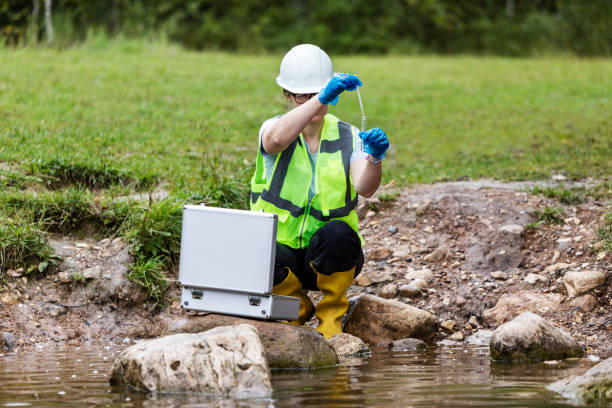
Fieldwork skills including drilling supervision and sample collection
4
Analytical skills for water quality testing and data interpretation
5
Knowledge of geophysical survey techniques
6
Ability to conduct environmental impact assessments
7
Effective communication and report writing skills
8
Problem-solving and critical thinking abilities
9
Collaboration and stakeholder engagement skills
10
Adaptability to diverse work environments and conditions
Hydrogeologist

Hydrogeologist

Hydrogeologists focus on the geological aspects of groundwater, studying rock formations, soil permeability, and subsurface water flow. They use...

0.0LPA
Groundwater Modeller

Groundwater Modeller

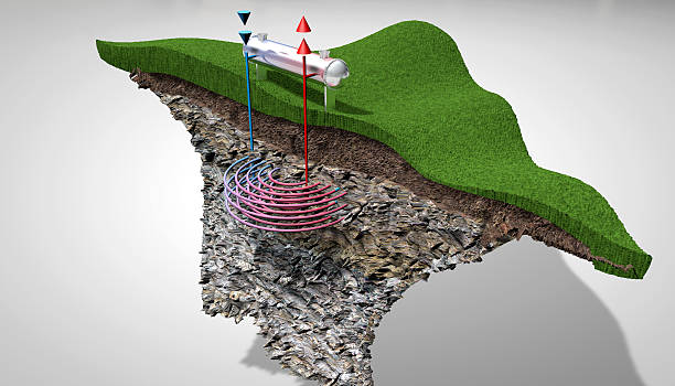
Groundwater Modelers develop computational models to simulate groundwater flow, contaminant transport, and recharge processes. They use software...

0.0LPA
Geophysicist ( Hydrogeophysics )

Geophysicist ( Hydrogeophysics )

Geophysicists apply geophysical techniques such as resistivity, seismic, and ground-penetrating radar to study subsurface water conditions. They...

0.0LPA

Interested in this career?

Take the next step and explore more about Geohydrologist.