
Geographer

A Geographer is a professional who studies the Earth's physical features, human societies, and their interactions, with the aim of understanding spatial patterns, environmental changes, and cultural landscapes. They work in academia, government agencies, environmental organizations, urban planning, or private consultancies, collaborating with scientists, policymakers, urban planners, and researchers. Geographers play a crucial role in addressing global challenges like climate change, urbanization, and resource management, providing spatial insights for sustainable development in a sector focused on environmental stewardship, data analysis, and societal impact.

Share :
Career tree mind map (horizontal) — Geographer
Colored branches, hub circles, and underlined topics — same style as counselor course classic (types 18–19 in admin).
Loading mind map…

Geographers are analytical and interdisciplinary professionals who investigate the relationships between people, places, and the environment using tools like Geographic Information Systems (GIS), remote sensing, and fieldwork. Their role involves mapping, data analysis, and policy recommendation, often working in diverse settings from research labs to disaster-prone regions. They combine expertise in physical sciences, social sciences, and technology to tackle challenges like environmental degradation, population dynamics, and spatial inequality. As key contributors to sustainable planning, they help shape policies and strategies for managing natural and human resources in an industry increasingly driven by climate urgency, technological innovation, and global connectivity.

  • Spatial Data Collection and Analysis
    • Gather data on physical landscapes, climate patterns, and human activities through fieldwork and surveys.
    • Analyze spatial data using GIS software to identify trends and patterns.
  • Mapping and Visualization
    • Create detailed maps, charts, and models to represent geographic information.
    • Use visualization tools to communicate findings to stakeholders or the public.
  • Environmental Research and Monitoring
    • Study natural phenomena like climate change, deforestation, or erosion to assess environmental impacts.
    • Monitor changes in land use, biodiversity, and ecosystems over time.
  • Urban and Regional Planning Support
    • Provide insights for urban development, transportation, and infrastructure planning.
    • Advise on zoning, land use, and sustainable growth strategies.
  • Policy and Decision-Making Support
    • Collaborate with governments or organizations to develop policies on resource management or disaster preparedness.
    • Offer recommendations based on geographic research for sustainable development.
  • Cultural and Human Geography Analysis
    • Research population distribution, migration, and cultural landscapes to understand societal trends.
    • Assess the impact of globalization or conflict on human geography.
  • Disaster Risk Assessment
    • Evaluate geographic vulnerabilities to natural disasters like floods or earthquakes.
    • Develop mitigation strategies to reduce risks in affected areas.
  • Education and Public Outreach
    • Teach geography at academic institutions or create educational materials on spatial issues.
    • Engage communities in understanding local environmental or cultural challenges.

RouteSteps
Route 11. 10+2 in any stream (preferably with Geography, Science, or Social Studies)
 2. Bachelor’s degree in Geography or Environmental Science (3-4 years)
 3. Internship or assistant role in geographic research (3-6 months)
 4. Practice as Junior Geographer or GIS Analyst
Route 21. 10+2 in any stream
 2. Bachelor’s degree in Geography or related field (3-4 years)
 3. Master’s degree in Geography, GIS, or Environmental Studies (1-2 years)
 4. Work as Geographer or Spatial Planner
Route 31. 10+2 in any stream
 2. Bachelor’s degree in Geography or Earth Sciences (3-4 years)
 3. Master’s degree in Geography or Remote Sensing (1-2 years)
 4. Ph.D. in Geography or Environmental Geography (3-5 years)
 5. Practice as Senior Geographer or Academician
Route 41. 10+2 in any stream
 2. Short-term certification or diploma in GIS or Remote Sensing (6-12 months)
 3. Internship or entry-level role in environmental or planning organizations
 4. Practice as Geographer domestically or internationally

  • Mandatory internships during degree programs in environmental agencies or urban planning for fieldwork experience.
  • Rotations in GIS labs for hands-on experience with spatial data analysis.
  • Internships under senior geographers for exposure to real-time environmental challenges.
  • Observerships in government bodies for experience in policy support and planning.
  • Participation in mock mapping projects for practical skill development in data visualization.
  • Training in remote sensing through real-world environmental monitoring projects.
  • Exposure to GIS software and geographic databases during internships.
  • Volunteer roles in conservation projects or disaster management during training to build a portfolio.
  • Community engagement initiatives for mapping local resources or cultural landscapes.
  • International geographic research attachments for global exposure to diverse spatial practices.

  • Certificate in Geographic Information Systems (GIS).
  • Bachelor’s in Geography, Environmental Science, or Earth Sciences.
  • Master’s in Geography, Remote Sensing, or Urban Planning.
  • Ph.D. in Geography or Environmental Geography.
  • Specialization in Human Geography.
  • Certification in Remote Sensing and Photogrammetry.
  • Workshops on Spatial Analysis.
  • Training in Cartography.
  • Specialization in Physical Geography.
  • Certification in Environmental Impact Assessment.

InstituteCourse/ProgramOfficial Link
University of Delhi, DelhiBA/MA/Ph.D. in Geographyhttps://www.du.ac.in/
Jawaharlal Nehru University (JNU), New DelhiMA/Ph.D. in Geographyhttps://www.jnu.ac.in/
Banaras Hindu University (BHU), VaranasiBA/MA/Ph.D. in Geographyhttps://www.bhu.ac.in/
University of Mumbai, MumbaiBA/MA in Geographyhttps://mu.ac.in/
University of Calcutta, KolkataBA/MA/Ph.D. in Geographyhttps://www.caluniv.ac.in/
Jamia Millia Islamia, New DelhiBA/MA in Geographyhttps://www.jmi.ac.in/
University of Madras, ChennaiMA/Ph.D. in Geographyhttps://www.unom.ac.in/
Amity University, NoidaBA/MA in Geographyhttps://www.amity.edu/
IGNOU (Indira Gandhi National Open University), New DelhiMA in Geographyhttp://www.ignou.ac.in/
Osmania University, HyderabadBA/MA in Geographyhttps://www.osmania.ac.in/

InstitutionCourseCountryOfficial Link
University of California, BerkeleyMA/Ph.D. in GeographyUSAhttps://www.berkeley.edu/
University of OxfordMPhil/DPhil in GeographyUKhttps://www.ox.ac.uk/
University of CambridgeMPhil/Ph.D. in GeographyUKhttps://www.cam.ac.uk/
University of British ColumbiaMA/Ph.D. in GeographyCanadahttps://www.ubc.ca/
Australian National University (ANU)Master of Geographical SciencesAustraliahttps://www.anu.edu.au/
University of TorontoMA/Ph.D. in GeographyCanadahttps://www.utoronto.ca/
University College London (UCL)MSc in GeographyUKhttps://www.ucl.ac.uk/
University of AmsterdamMSc in Human GeographyNetherlandshttps://www.uva.nl/
ETH ZurichMaster in Spatial DevelopmentSwitzerlandhttps://ethz.ch/
National University of Singapore (NUS)MSc in Applied GISSingaporehttps://www.nus.edu.sg/

India:

  • DUET (Delhi University Entrance Test): For admission to postgraduate programs at University of Delhi.
  • JNU Entrance Exam (JNUEE): For admission to MA programs at Jawaharlal Nehru University.
  • BHU PET (Postgraduate Entrance Test): For admission to MA programs at Banaras Hindu University.
  • JAM (Joint Admission Test for Masters): For admission to certain geography-related programs at IITs.
  • University-Specific Tests: Many institutes like Amity and Jamia Millia Islamia conduct their own entrance exams.


International:

  • SAT (Scholastic Assessment Test): Required for undergraduate admissions in countries like the USA.
  • GRE (Graduate Record Examination): Required for postgraduate programs in geography in countries like the USA and Canada.
  • TOEFL (Test of English as a Foreign Language): Minimum score of 80-100 required for non-native speakers applying to programs in English-speaking countries.
  • IELTS (International English Language Testing System): Minimum score of 6.0-7.0 required for admission to universities in the UK, Australia, and other English-speaking regions.
  • PTE Academic (Pearson Test of English Academic): Accepted by many international institutes as an alternative to TOEFL or IELTS for English proficiency.

Trainee → Junior Geographer → Geographer → Senior Geographer → GIS Specialist → Environmental Consultant → Academician/Professor → Policy Advisor

  • Government agencies for environmental policy and disaster management.
  • Environmental organizations for conservation and sustainability research.
  • Urban planning departments for city development and land use strategies.
  • Academic institutions for teaching and conducting geographic research.
  • Private consultancies for spatial analysis and environmental impact assessments.
  • International organizations like UN or NGOs for global development projects.
  • Technology firms for GIS and mapping software development.
  • Natural resource management for monitoring land, water, and mineral use.
  • Transportation sectors for route planning and logistics optimization.
  • Media and publishing for creating geographic content and visualizations.

IndiaInternational
Survey of IndiaUnited States Geological Survey (USGS)
National Remote Sensing Centre (NRSC)European Space Agency (ESA)
Indian Space Research Organisation (ISRO)National Geographic Society
Ministry of Environment, Forest and Climate ChangeWorld Wildlife Fund (WWF)
National Disaster Management Authority (NDMA)United Nations Environment Programme (UNEP)
Forest Survey of India (FSI)Google Maps
Geological Survey of India (GSI)Environmental Systems Research Institute (ESRI)
Central Ground Water Board (CGWB)International Union for Conservation of Nature (IUCN)
National Institute of Urban Affairs (NIUA)NASA Earth Science Division
Indian Meteorological Department (IMD)Ordnance Survey, UK

ProsCons
Opportunity to address global challenges like climate change through spatial insightsOften requires extensive fieldwork in challenging or remote environments
High intellectual satisfaction in understanding human-environment interactionsLimited job openings in specialized geographic roles, leading to competition
Rewarding impact on sustainability and urban planning through researchCan involve physically demanding tasks like surveys or long travel periods
Diverse career paths across government, academia, and environmental sectorsRisk of funding shortages for research or conservation projects
Strong potential for growth with increasing focus on GIS and climate solutionsLimited public recognition compared to other scientific or technical professions

Career LevelIndia (₹ per annum)International (USD per annum)
Trainee/Junior Geographer (Early Career)2,50,000 - 5,00,00030,000 - 45,000
Geographer (Mid-Career)5,00,000 - 10,00,00045,000 - 70,000
Senior Geographer/GIS Specialist10,00,000 - 15,00,00070,000 - 100,000
Environmental Consultant/Policy Advisor15,00,000 - 20,00,000100,000 - 130,000
Academician/Professor12,00,000+90,000+
Note: Salaries may vary based on location, employer, experience, and specialization.  

  • GIS Software (e.g., ArcGIS, QGIS) for spatial data analysis and mapping.
  • Remote Sensing Tools (e.g., ERDAS Imagine, ENVI) for satellite imagery analysis.
  • Data Visualization Platforms (e.g., Tableau) for presenting geographic trends.
  • Programming Tools (e.g., Python, R) for geospatial data modeling.
  • Mapping Software (e.g., Google Earth Pro) for creating and viewing maps.
  • Database Management Systems (e.g., PostgreSQL with PostGIS) for handling spatial datasets.
  • Survey Tools (e.g., Survey123) for field data collection.
  • Climate Modeling Software (e.g., SWAT) for environmental simulations.
  • Project Management Software (e.g., Trello, Asana) for coordinating research projects.
  • 3D Modelling Tools (e.g., SketchUp) for visualizing geographic features.

  • Indian Geographical Society (IGS).
  • Association of American Geographers (AAG), USA.
  • Royal Geographical Society (RGS), UK.
  • International Geographical Union (IGU).
  • National Geographic Society, USA.
  • Indian National Cartographic Association (INCA).
  • Society of Indian Geographers (SIG).
  • European Association of Geographers (EUROGEO).
  • Canadian Association of Geographers (CAG).
  • Global Spatial Data Infrastructure Association (GSDI).

  • David Harvey (Human Geography, UK/USA): Renowned for Marxist geography and urban studies. His work on spatial justice inspires globally. His impact shapes urban theory.
     
  • Yi-Fu Tuan (Human Geography, USA): Known for humanistic geography and concepts of space and place. His ideas redefine cultural landscapes. His contributions influence spatial thought.
     
  • Doreen Massey (Human Geography, UK): Pioneered feminist geography and spatial politics. Her research on globalization reshapes theory. Her impact drives social geography.
     
  • Gilbert F. White (Environmental Geography, USA): Known for work on natural hazards and floodplain management. His strategies save lives. His contributions shape disaster policy.
     
  • Jared Diamond (Environmental Geography, USA): Author of "Guns, Germs, and Steel," known for geographic determinism. His books educate globally. His impact influences historical geography.
     
  • Anil K. Gupta (Environmental Geography, India): Known for disaster management and climate resilience research. His policies protect vulnerable regions. His contributions elevate Indian geography.
     
  • R.B. Singh (Environmental Geography, India): Expert in sustainable development and urban geography. His research informs policy. His impact drives environmental planning.
     
  • Kapil Kumar Gavsker (Physical Geography, India): Known for climate and monsoon studies in India. His work aids agricultural planning. His contributions shape regional research.
     
  • Ellen Churchill Semple (Historical Geography, USA): Early pioneer in environmental determinism and cultural geography. Her writings laid foundational theories. Her impact influences modern geography.
     
  • Anne Buttimer (Human Geography, Ireland): Known for humanistic approaches to geography and sustainability. Her focus on lived experience inspires. Her contributions enrich cultural studies.
     

  • Build a strong foundation in physical and human geography to analyze spatial relationships effectively.
  • Seek early exposure to fieldwork through internships or assistant roles to confirm interest in the field.
  • Prepare thoroughly for entrance exams or certification requirements specific to your chosen program or region.
  • Pursue short courses in GIS, remote sensing, or environmental analysis to gain expertise.
  • Stay updated on global environmental trends by following industry journals and attending conferences.
  • Develop hands-on skills in mapping software and spatial analysis through practical assignments and projects.
  • Engage in real-world geographic research or volunteer at conservation organizations to build experience.
  • Join professional associations like AAG or RGS for networking and resources.
  • Work on analytical precision and visualization to ensure impactful geographic insights.
  • Explore international geographic opportunities for exposure to diverse environmental and cultural contexts.
  • Volunteer at local environmental projects or disaster relief initiatives to understand practical challenges.
  • Cultivate adaptability to handle various geographic data types and research environments.
  • Attend continuing education programs to stay abreast of evolving GIS tools and geographic theories.
  • Build a network with environmentalists, planners, and policymakers for collaborative efforts.
  • Develop resilience to manage the rigorous and often field-intensive nature of geographic work.
  • Balance analytical rigor with creativity to adapt to rapid advancements in spatial technology and environmental policy.

A career as a Geographer offers a unique opportunity to explore the intricate connections between the Earth’s landscapes and human societies, shaping solutions for a sustainable future. Geographers are the stewards of spatial knowledge, using data and technology to address pressing issues like climate change, urbanization, and resource scarcity. This profession blends scientific inquiry with societal impact, providing diverse pathways in environmental research, urban planning, academia, and policy development. For those passionate about understanding the world’s physical and cultural tapestry, eager to tackle global challenges, and driven to contribute to informed decision-making in an era of environmental and technological transformation, becoming a Geographer is a deeply rewarding journey. It empowers individuals to drive progress by mapping out strategies that enhance resilience and harmony across communities and ecosystems worldwide.

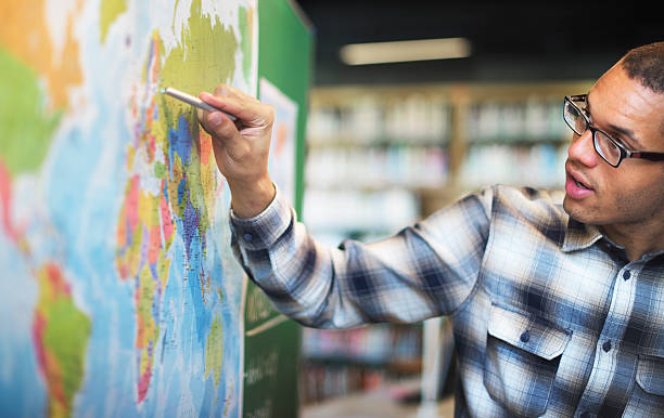
Knowledge & Skills You Will Learn
1
Rising Demand:Growing need for geographers skilled in remote sensing and climate modeling.
2
Skill Development Needs:Growing necessity for training in GIS software and data analytics.
Senior Geographer

Senior Geographer

Specialists oversee major geographic projects and policy recommendations with exceptional competence. They integrate deep spatial knowledge with...

0.0LPA
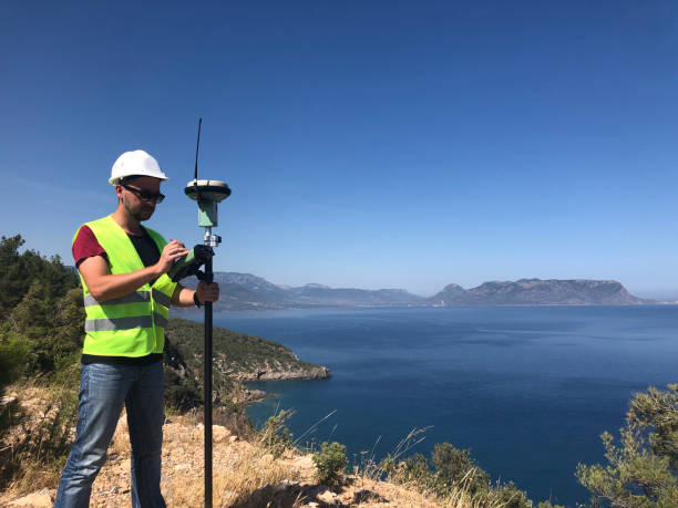
GIS Specialist

GIS Specialist

Senior professionals specialize in spatial data systems, ensuring innovation. They provide leadership by managing GIS projects and high-priority...

0.0LPA

Environmental Consultant

Environmental Consultant

Leaders provide strategic guidance on environmental projects in organizational or governmental settings. They oversee initiatives by aligning...

0.0LPA

Interested in this career?

Take the next step and explore more about Geographer.