Environmental GIS Specialist

An Environmental GIS Specialist is a professional dedicated to using Geographic Information Systems (GIS) technology to analyze, map, and manage environmental data for conservation, resource management, and policy-making to support sustainable environmental practices. They work in government agencies, environmental consultancies, research institutions, non-profit organizations, and private sectors, collaborating with ecologists, urban planners, and policymakers. Environmental GIS Specialists play a critical role in addressing environmental challenges like habitat loss, climate change, and pollution through spatial data analysis in a world increasingly focused on data-driven environmental solutions, sustainability, and ecological resilience.
Share :
Career tree mind map (horizontal) — Environmental GIS Specialist
Colored branches, hub circles, and underlined topics — same style as counselor course classic (types 18–19 in admin).
Loading mind map…

Environmental GIS Specialists are experts in geospatial technologies and environmental science, responsible for collecting, analyzing, and visualizing spatial data to support environmental monitoring, planning, and decision-making. Their role involves creating detailed maps, modeling environmental trends, and assessing spatial impacts, often working in diverse settings such as offices with GIS software, field sites for data collection, or collaborative project environments. They combine expertise in GIS tools, remote sensing, and ecological knowledge to address issues like deforestation, urban sprawl, and natural disaster risks. As key contributors to environmental sustainability, they help inform strategies for ecosystem protection in an era prioritizing spatial analytics, climate adaptation, and global conservation efforts.

  • Spatial Data Collection and Management
    • Gather environmental data through field surveys, remote sensing, and existing databases for GIS integration.
    • Manage and maintain spatial databases to ensure data accuracy and accessibility for environmental projects.
  • Environmental Mapping and Visualization
    • Create detailed maps and visualizations of environmental features like land use, vegetation cover, and pollution zones.
    • Use GIS software to produce thematic maps for stakeholder presentations and reports.
  • Spatial Analysis and Modeling
    • Analyze spatial data to identify environmental trends, such as habitat fragmentation or flood risk areas.
    • Develop models to predict environmental changes, like urban expansion impacts on ecosystems.
  • Impact Assessment Support
    • Assist in environmental impact assessments by mapping project areas and analyzing potential ecological effects.
    • Provide spatial insights for infrastructure projects to minimize environmental disruption.
  • Conservation and Resource Planning
    • Support conservation efforts by mapping biodiversity hotspots, protected areas, and wildlife corridors.
    • Aid in natural resource management by analyzing spatial distribution of resources like water or forests.
  • Policy and Decision Support
    • Provide GIS-based reports and recommendations to policymakers for environmental planning and zoning.
    • Collaborate with government bodies to develop spatial strategies for sustainable development.
  • Disaster Risk Mapping
    • Map areas prone to natural disasters like landslides or floods to support mitigation planning.
    • Integrate real-time data for emergency response and environmental crisis management.
  • Training and Collaboration
    • Train colleagues or stakeholders in GIS tools and spatial data interpretation for environmental projects.
    • Work with interdisciplinary teams to integrate GIS data into broader environmental research or initiatives.

RouteSteps
Route 1

1. 10+2 with Physics, Chemistry, Mathematics (PCM) or Biology (PCB).

2. Bachelor’s degree in Environmental Science, Geography, or Geoinformatics (3-4 years).

3. Gain practical experience through internships or training in GIS-focused environmental organizations (3-6 months).

4. Pursue entry-level roles like GIS Technician or Environmental Data Assistant (1-2 years).

Route 2

1. 10+2 with PCM or PCB.

2. Bachelor’s degree in Earth Sciences, Remote Sensing, or Computer Science (3-4 years).

3. Master’s degree in Geoinformatics, Environmental GIS, or Spatial Data Science (2 years, optional).

4. Work in GIS mapping or environmental data analysis roles to gain experience (1-2 years).

5. Transition to Environmental GIS Specialist roles with enhanced skills and knowledge.

Route 3

1. 10+2 with PCM or PCB.

2. Bachelor’s degree in Geography, Environmental Science, or related field (3-4 years).

3. Pursue professional certifications like Certified GIS Professional (GISP) or Environmental Spatial Analyst (1-2 years).

4. Gain hands-on experience through roles in environmental mapping or spatial analysis (1-2 years).

5. Establish a career as an Environmental GIS Specialist in government agencies or NGOs.

Route 4

1. 10+2 with PCM or PCB.

2. Bachelor’s degree from India in Geoinformatics, Environmental Science, or related field (3-4 years).

3. Pursue international GIS certifications or advanced degrees abroad (1-2 years).

4. Gain exposure through roles in global environmental GIS projects or international organizations (1-2 years).

5. Work as an Environmental GIS Specialist in international markets or global NGOs.

  • Mandatory field training during degree programs in environmental data collection for GIS applications.
  • Rotations in GIS-focused environmental organizations for hands-on experience in spatial mapping and analysis.
  • Internships under senior GIS specialists for exposure to real-time environmental mapping and modeling projects.
  • Observerships in government environmental or urban planning departments for insights into GIS policy applications.
  • Participation in GIS-based environmental surveys and mapping simulations for practical skill development.
  • Training in spatial data collection techniques through real-world field engagements.
  • Exposure to GIS tools like ArcGIS, QGIS, and remote sensing software during internships.
  • Field projects on environmental impact mapping or resource distribution analysis during training.
  • Community outreach programs to educate locals on GIS-based environmental monitoring and planning.
  • International GIS project attachments for global exposure to diverse environmental spatial analysis challenges.

  • Certificate in Geographic Information Systems (GIS) for Environmental Applications
  • Bachelor’s in Geoinformatics, Environmental Science, or Geography
  • Master’s in Geoinformatics, Environmental GIS, or Spatial Data Science
  • Ph.D. in Environmental Spatial Analysis or Geospatial Technologies
  • Specialization in Environmental Impact Mapping
  • Certification in Remote Sensing for Environmental Monitoring
  • Workshops on GIS Modeling for Climate Change Analysis
  • Training in Spatial Data Management for Natural Resources
  • Specialization in Urban Environmental GIS
  • Certification in GIS for Biodiversity and Conservation Planning

InstituteCourse/ProgramOfficial Link
Indian Institute of Remote Sensing (IIRS), DehradunM.Tech in Remote Sensing and GIShttps://www.iirs.gov.in/
Jawaharlal Nehru University (JNU), New DelhiM.Sc. in Environmental Sciences (GIS Focus)https://www.jnu.ac.in/
TERI School of Advanced Studies, New DelhiM.Sc. in Geoinformaticshttps://www.terisas.ac.in/
University of Delhi, DelhiM.Sc. in Environmental Studies (GIS Electives)https://www.du.ac.in/
Banaras Hindu University (BHU), VaranasiM.Sc. in Environmental Science (GIS Focus)https://www.bhu.ac.in/
Indian Institute of Science (IISc), BangaloreM.Sc. in Ecological Sciences (Spatial Analysis)https://www.iisc.ac.in/
Savitribai Phule Pune University, PuneM.Sc. in Geoinformaticshttps://www.unipune.ac.in/
Amity University, NoidaB.Sc./M.Sc. in Geoinformaticshttps://www.amity.edu/
Anna University, ChennaiM.E. in Remote Sensing and Geomaticshttps://www.annauniv.edu/
Madras Institute of Technology (MIT), ChennaiM.Tech in Geoinformaticshttps://www.mitindia.edu/

InstitutionCourseCountryOfficial Link
Stanford UniversityEnvironmental Science (GIS Focus)USAhttps://www.stanford.edu/
University of California, BerkeleyGeospatial Information ScienceUSAhttps://www.berkeley.edu/
Wageningen University & ResearchGeo-Information Science and Remote SensingNetherlandshttps://www.wur.nl/
University of OxfordEnvironmental GIS and Spatial AnalysisUKhttps://www.ox.ac.uk/
Massachusetts Institute of Technology (MIT)Urban Studies and GISUSAhttps://www.mit.edu/
University of MelbourneGeospatial Science and Environmental ManagementAustraliahttps://www.unimelb.edu.au/
University of British ColumbiaGIS and Environmental ScienceCanadahttps://www.ubc.ca/
ETH ZurichGeomatic Engineering and PlanningSwitzerlandhttps://www.ethz.ch/
University of CopenhagenGeoinformatics and Environmental AnalysisDenmarkhttps://www.ku.dk/
National University of Singapore (NUS)Geospatial and Environmental StudiesSingaporehttps://www.nus.edu.sg/

India:

  • IIRS Entrance Exam: For admission to M.Tech programs in Remote Sensing and GIS at Indian Institute of Remote Sensing.
  • JNU CEEB (Combined Entrance Examination for Biotechnology): For admissions in environmental science programs at JNU.
  • GATE (Graduate Aptitude Test in Engineering): For admission to M.Tech programs in geoinformatics or related fields at various institutes.
  • State-Level Entrance Exams: Various states conduct exams for admission to GIS or environmental programs in state universities.
  • NET (National Eligibility Test): For research fellowships or lectureship roles in environmental GIS.

International:

  • TOEFL (Test of English as a Foreign Language): Minimum score of 80-100 required for non-native speakers applying to programs in English-speaking countries.
  • IELTS (International English Language Testing System): Minimum score of 6.0-7.0 required for admission to universities in the UK, Australia, and other regions.
  • PTE Academic (Pearson Test of English Academic): Accepted by many international institutes as an alternative to TOEFL or IELTS for English proficiency.

GIS Technician → Environmental GIS Analyst → Senior Environmental GIS Specialist → GIS Project Manager → Environmental GIS Consultant → GIS Program Director → Academician/Researcher

  • Government environmental departments for mapping and monitoring ecological health.
  • Research institutions for studying spatial environmental trends and resource distribution.
  • Non-profit organizations for advocating GIS-based conservation and sustainability.
  • Environmental consultancies for conducting spatial impact assessments for projects.
  • Academic institutions for teaching and researching GIS in environmental contexts.
  • Urban planning bodies for integrating environmental GIS into city development plans.
  • Forestry and wildlife departments for mapping habitats and biodiversity hotspots.
  • International environmental agencies for global GIS-based ecological initiatives.
  • Disaster management authorities for spatial risk assessment and mitigation planning.
  • Corporate sustainability divisions for evaluating spatial environmental impacts of operations.

IndiaInternational
Ministry of Environment, Forest and Climate Change (MoEFCC)World Wildlife Fund (WWF), Global
Indian Institute of Remote Sensing (IIRS), DehradunInternational Union for Conservation of Nature (IUCN), Global
Forest Survey of India (FSI)World Resources Institute (WRI), Global
National Remote Sensing Centre (NRSC), HyderabadThe Nature Conservancy, USA
Survey of IndiaUnited Nations Environment Programme (UNEP), Global
WWF-IndiaGreenpeace International, Global
Centre for Science and Environment (CSE), New DelhiEsri (Environmental Systems Research Institute), USA
TERI - The Energy and Resources Institute, New DelhiEuropean Environment Agency (EEA), Europe
State Environment and Urban Development Departments (e.g., Tamil Nadu, Maharashtra)Global Land Analysis & Discovery (GLAD), USA
Wildlife Institute of India (WII), DehradunNASA Earth Science Division, USA

ProsCons
Direct impact on environmental decision-making through spatial data insightsHigh dependency on technology, requiring constant software and hardware updates
Growing demand due to increasing need for data-driven environmental solutionsCan involve repetitive data processing tasks, leading to monotony
Opportunity to contribute to conservation, urban planning, and disaster mitigationLimited field exposure in some roles, focusing heavily on desk-based analysis
Varied career paths in research, policy support, consultancy, and technologyNeed for continuous learning to keep up with rapidly evolving GIS technologies
Potential for societal change through GIS-based sustainable environmental strategiesChallenges in data accuracy and availability, especially in remote Indian regions

Career LevelIndia (₹ per annum)International (USD per annum)
GIS Technician (Early Career)3,00,000 - 5,50,00045,000 - 60,000
Environmental GIS Analyst (Mid-Career)5,50,000 - 9,00,00060,000 - 80,000
Senior Environmental GIS Specialist9,00,000 - 13,00,00080,000 - 100,000
GIS Project Manager13,00,000 - 18,00,000100,000 - 120,000
Environmental GIS Consultant/GIS Program Director/Academician/Researcher18,00,000 - 25,00,000120,000 - 140,000+

Note: Salaries may vary based on location, employer, experience, and specialization. Indian figures are updated estimates based on current industry trends, government pay scales, and private sector data as of 2025, reflecting inflation and demand growth in geospatial and environmental sectors. International figures are based on data from the U.S., Canada, and Europe as of 2025, adjusted for market trends in GIS and environmental roles, sourced from industry reports and salary surveys like Glassdoor and PayScale. Due to the speculative nature of future data, these are approximations and may differ based on real-time economic factors.

  • Geographic Information Systems (GIS) Software (e.g., ArcGIS, QGIS) for environmental mapping and analysis.
  • Remote Sensing Software (e.g., ENVI, ERDAS Imagine) for processing satellite imagery of environmental features.
  • Data Visualization Tools (e.g., Tableau, Power BI) for presenting spatial environmental data.
  • Spatial Database Management Tools (e.g., PostgreSQL with PostGIS) for storing and querying environmental GIS data.
  • Programming Languages (e.g., Python, R) for automating GIS workflows and spatial analysis.
  • Teleconferencing tools like Zoom for collaboration with global environmental and GIS teams.
  • Cloud GIS Platforms (e.g., Google Earth Engine, ArcGIS Online) for scalable environmental data analysis.
  • Microsoft Office Suite for documentation and GIS project presentations.
  • Project Management Tools (e.g., Trello, Monday.com) for coordinating GIS-based environmental initiatives.
  • Drone Mapping Software (e.g., Pix4D, DroneDeploy) for aerial environmental data collection and analysis.

  • Indian Society of Remote Sensing (ISRS)
  • National Remote Sensing Centre (NRSC), India
  • International Society for Photogrammetry and Remote Sensing (ISPRS)
  • GIS Certification Institute (GISCI)
  • Urban and Regional Information Systems Association (URISA)
  • Open Geospatial Consortium (OGC)
  • American Association of Geographers (AAG)
  • European Association of Remote Sensing Laboratories (EARSeL)
  • Global Spatial Data Infrastructure Association (GSDI)

  • Dr. K. Kasturirangan (Contemporary, India): Former ISRO Chairman, instrumental in advancing remote sensing and GIS for environmental monitoring in India. His leadership shaped satellite-based mapping. His policies influenced resource management. He chaired key environmental panels.
     
  • Dr.ShaileshNayak (Contemporary, India): Former Director of Indian National Centre for Ocean Information Services (INCOIS), known for GIS applications in coastal and environmental management. His work aids disaster mapping. His leadership drives spatial policy. He authored key geospatial texts.
     
  • Dr. R.R. Navalgund (Contemporary, India): Former Director of Space Applications Centre (ISRO), focusing on remote sensing and GIS for environmental and agricultural monitoring. His innovations support sustainability. His research shapes mapping tools. He mentored geospatial experts.
     
  • Dr. A.S. Kiran Kumar (Contemporary, India): Former ISRO Chairman, known for advancing GIS and satellite technology for environmental applications. His contributions enhance disaster management. His leadership drives spatial data policy. He pioneered environmental mapping missions.
     
  • Dr.Madhavan Nair Rajeevan (Contemporary, India): Former Secretary of Ministry of Earth Sciences, focusing on GIS for climate and environmental analysis. His work supports weather mapping. His policies influence spatial research. He authored key environmental studies.
     
  • Dr. Jack Dangermond (Contemporary, USA): Founder of Esri, the leading GIS software company, revolutionizing environmental GIS applications globally. His tools shape spatial analysis. His leadership drives innovation. He pioneered digital mapping for conservation.
     
  • Dr. Dawn Wright (Contemporary, USA): Chief Scientist at Esri, known for GIS applications in marine and environmental conservation. Her work maps ocean ecosystems. Her advocacy shapes geospatial policy. She authored key GIS texts.
     
  • Dr. Michael F. Goodchild (Contemporary, USA/Canada): Geographer and GIS pioneer, known for advancing spatial data science for environmental analysis. His research defines GIS theory. His leadership influences standards. He authored foundational geospatial works.
     
  • Dr. Roger Tomlinson (Historical, Canada): Known as the “Father of GIS,” who developed the first computerized GIS for environmental planning. His innovations shaped modern mapping. His work influenced conservation. He pioneered GIS until his passing in 2014.
     
  • Dr. Cynthia Brewer (Contemporary, USA): Geographer at Penn State University, known for GIS visualization and environmental mapping techniques. Her research improves map design. Her tools aid conservation planning. She authored key cartography texts.
     

  • Build a strong foundation in environmental science, geography, and geospatial technologies to understand GIS applications.
  • Seek early exposure to GIS software and environmental data projects through internships to confirm interest in the field.
  • Prepare thoroughly for entrance exams or certification requirements specific to your chosen program or region.
  • Pursue certifications in GIS, remote sensing, or spatial data analysis to gain expertise in environmental contexts.
  • Stay updated on advancements in GIS tools and environmental mapping by attending industry conferences and workshops.
  • Develop hands-on skills in spatial data collection, mapping, and analysis through practical training.
  • Engage in GIS-based environmental research or mapping projects to build real-world experience.
  • Join professional associations like the Indian Society of Remote Sensing (ISRS) for resources and networking.
  • Work on precision and technical skills to ensure accurate spatial data and environmental map outputs.
  • Explore international GIS projects for exposure to diverse environmental spatial challenges and global standards.
  • Volunteer in community environmental mapping or awareness programs to understand local spatial data needs.
  • Cultivate adaptability to handle technical and data-related challenges in diverse environmental settings.
  • Attend continuing education programs to stay abreast of evolving GIS technologies and environmental issues.
  • Build a network with GIS experts, environmental scientists, and policymakers for collaborative efforts.
  • Develop resilience to manage the technical and logistical pressures of GIS-based environmental work.
  • Balance technical GIS skills with environmental knowledge to adapt to rapid changes in spatial data priorities.

A career as an Environmental GIS Specialist offers a unique opportunity to contribute to environmental protection and global sustainability by leveraging geospatial technologies to analyze and manage ecological data across diverse landscapes. From mapping biodiversity hotspots to shaping data-driven environmental policies, Environmental GIS Specialists play a pivotal role in modern environmental stewardship and sustainable planning. This field combines technical expertise, spatial analysis, and a commitment to ecological and societal well-being, offering diverse paths in research, policy support, and technology-driven conservation. For those passionate about merging technology with nature, adapting to global environmental challenges, and addressing critical spatial data needs in an era of increasing environmental urgency, a career as an Environmental GIS Specialist provides an intellectually stimulating and professionally rewarding journey with the potential to make significant contributions to society by enhancing ecosystem health and sustainability worldwide.

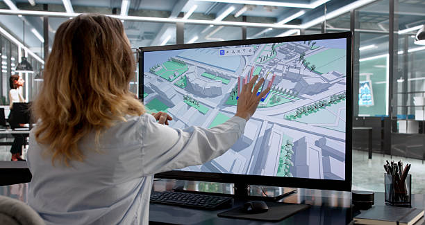
Knowledge & Skills You Will Learn
1
Technological Advancements: Adoption of AI, machine learning, and cloud-based GIS platforms for enhanced spatial analysis, creating new skill demands.
2
Skill Development Needs: Demand for training in advanced GIS tools, drone mapping, and interdisciplinary environmental applications.
GIS Technician

GIS Technician

Entry-level professionals assist in spatial data collection, basic mapping, and database management under supervision in organizations like the...

0.0LPA

Environmental GIS Analyst

Environmental GIS Analyst

Mid-level specialists analyze spatial data to map environmental trends, such as deforestation or pollution spread, working in entities like the...

0.0LPA

Senior Environmental GIS Specialist

Senior Environmental GIS Specialist

Experienced specialists lead complex GIS projects, oversee spatial analysis, and mentor junior staff in research bodies like the Forest Survey of...

0.0LPA

Interested in this career?

Take the next step and explore more about Environmental GIS Specialist.